A Lewis & Clark Adventure With Katelyn - Page 4
The next morning, we decided to head for the Lewis and Clark Interpretive Center at Cape Disappointment. On the way, we again followed the general route by road that William Clark and eleven men took overland on their way to Cape Disappointment on November 18, 1805. The journal on this day reads as follows: "He [Captain Clark] proceeded along the beach one mile to a point of rocks about forty feet high [Chinook Point], where the hills retire, leaving a wide beach, and a number of ponds covered with water-fowl, between which and the mountain is a narrow bottom of alder and small balsam trees. Seven miles from the rocks is the entrance of a creek [Chinook River], or rather drain from the ponds and hills, where is a cabin of Chinnooks. We were taken across in a canoe by two squaws, to each of whom we gave a fishhook, and then coasting along the bay, passed at two miles the low bluff of a small hill, below which are the ruins of some old huts, and close to it the remains of a whale. The country is low, open and marshy; interspersed with some high pine and a thick undergrowth. Five miles from the creek, we came to a stream forty yards wide at low water, which we called Chinnook river [Wallacut River]. The hills up this river and towards the bay [Baker Bay] are not high, but very thickly covered with large pine of several species: in many places pine trees, three or four feet in thickness, are seen growing on the bodies of large trees, which though fallen and covered with moss, were in part sound. Here we dined on some brant and plover, killed as we came along, and after crossing in a boat lying in the sand near some old houses, proceeded along a bluff of yellow clay and soft stone [Yellow Bluff] to a little bay or harbour, into which a drain from some ponds empties [location of today's Illwaco, Washington]: at this harbour the land is low, but as we went on it rose to hills of eighty or ninety feet above the water. At the distance of one mile is a second bay, and a mile beyond it, a small rocky island in a deep bend, which seems to afford a very good harbour, and where the natives inform us European vessels anchor for the purpose of trading. We went on round another bay, in which is a second small island of rocks, and crossed a small stream, which rises in a pond near the sea coast [O'Neil Lake], and after running through a low isthmus empties into the bay [today this area is Cape Disappointment State Park]. This narrow low ground, about two or three hundred yards wide, separates from the main hills a kind of peninsula, the extremity of which is two miles from the anchoring place; and this spot, which was called cape Disappointment [and still is], is an elevated, circular knob, rising with a steep ascent one hundred and fifty or one hundred and sixty feet above the water, formed like the whole shore of the bay, as well as of the seacoast, and covered with thick timber on the inner side, but open and grassy in the exposure next the sea. From this cape a high point of land [Tillamook Head] bears south 20 o west, about twenty-five miles distant. In the range between these two eminences, is the opposite point of the bay, a very low ground, which has been variously called cape Rond by Lapeyrouse, and point Adams by Vancouver. The water for a great distance off the mouth of the river, appears very shallow, and within the mouth nearest to point Adams [still Point Adams today], is a large sandbar [Clatsop Spit], almost covered at high tide. We could not ascertain the direction of the deepest channel, for the waves break with tremendous force the whole distance across the bay, but the Indians point nearer to the opposite side as the best passage. After remaining for some time on this elevation, we descended across the low isthmus, and reached the ocean at the foot of a high hill [McKenzie Head], about a mile in circumference, and projecting into the sea. We crossed this hill, which is open and has a growth of high coarse grass, and encamped on the north side of it, having made nineteen miles. Besides the pounded fish and brant, we had for supper a flounder, which we picked up on the beach".
 |
 |
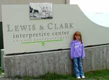
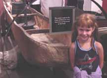
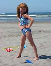
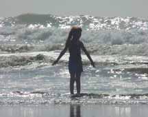
The Interpretive Center at Cape Disappointment was very enlightening and very well put together in the way it tells the story of Lewis and Clark from the start of the journey to its Pacific destination. Many of the exhibits have "hands on" displays that allow one to better understand what was involved in the journey. The center itself is situated on a high bluff overlooking an expansive vista of the Pacific Ocean with thunderous waves pounding the cliffs below. It is reached via a quarter mile trail through the woods of Sitka Spruce from a parking lot, which is located below and behind the center. From here there is also a 3/4-mile trail, which leads to the Cape Disappointment Lighthouse just south of the center. Katelyn seemed to enjoy the exhibits and displays at the center and she also made the hike to the lighthouse and back. When we finished here, we headed north and it was not long before we drove into Longbeach, Washington and then turned left on a road that took us right out onto the ocean beach. We stopped here for a while so that Katelyn could run in the soft sand, get her feet wet, feel the soft salt air in her face, and hear the thundering roar of the waves as they pounded the shore for miles in each direction.
 |
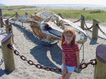 |
This spot on the beach is also where Clark and his party of men passed by on their next day away from Station Camp. The journal for November 19, 1805 states: "In the night it began to rain, and continued till eleven o'clock. Two hunters were sent on to kill something for breakfast, and the rest of the party after drying their blankets soon followed. At three miles we overtook the hunters, and breakfasted on a small deer, which they had been fortunate enough to kill. We then continued over rugged hills and steep hollows, near the sea, on a course about north 20° west, in a direct line from the cape [Cape Disappointment], till at the distance of five miles, we reached a point of high land, below which a sandy beach extends, in a direction north 10° west, [Long Beach Peninsula] to another high point about twenty miles distant. This eminence we distinguished by the name of point Lewis [Leadbetter Point]. It is there that the highlands, which at the commencement of the sandy beach, recede towards Chinnook river, again approach the ocean. The intermediate country is low, with many small ponds, crowded with birds, and watered by the Chinnook [Willapa Bay, Willapa National Wildlife Refuge, and the Naselle River], on the borders of which resides the nation of the same name. We went four miles along the sandy beach to a small pine tree, on which captain Clarke marked his name, with the year and day, and then returned to the foot of the hills, passing on the shore a sturgeon ten feet long, and several joints of the back bone of a whale, both which seem to have been thrown ashore and foundered. After dining on the remains of the small deer, we crossed in a southeastern direction to the bay [Baker Bay], where we arrived at the distance of two miles, then continued along the bay, crossed Chinnook river [Wallacut River]. The journal for November 20, 1805 states: "It rained in the course of the night. A hunter despatched early to kill some food, returned with eight ducks, on which we breakfasted, and then followed the course of the bay [Baker Bay] to the creek or outlet of the ponds [Chinook River]. It was now high tide, the stream three hundred yards wide, and no person in the cabin to take us across. We therefore made a small raft, on which one of the men passed and brought a canoe to carry us over. As we went along the beach we were overtaken by several Indians, who gave us dried sturgeon and wappatoo roots, and soon met several parties of Chinnooks returning from the camp [Station Camp]".
 |
 |
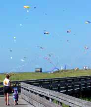 |
The next day we decided to head over to Astoria, Oregon to visit the city and do some shopping. We did not know that a parade was scheduled to wind its way through town and that we would get the privilege of watching. We soon found ourselves sitting on a curb in the middle of town and enjoying clowns, bands, floats, and all those other things associated with a parade. To our surprise, one of the groups marching by were descendants of the Lewis & Clark party. There must have been about a hundred of them. Katelyn enjoyed the parade, especially the clowns, as it was not something she was expecting to see. We then spent another two days just having fun on the beach since the weather was very warm and sunny. Also during this time, Long Beach was having a kite festival and there were hundreds of kites flying in the gentle breezes off the ocean.